
US-Indian NISAR Space Mission Maps Extreme Subsidence in Mexico City


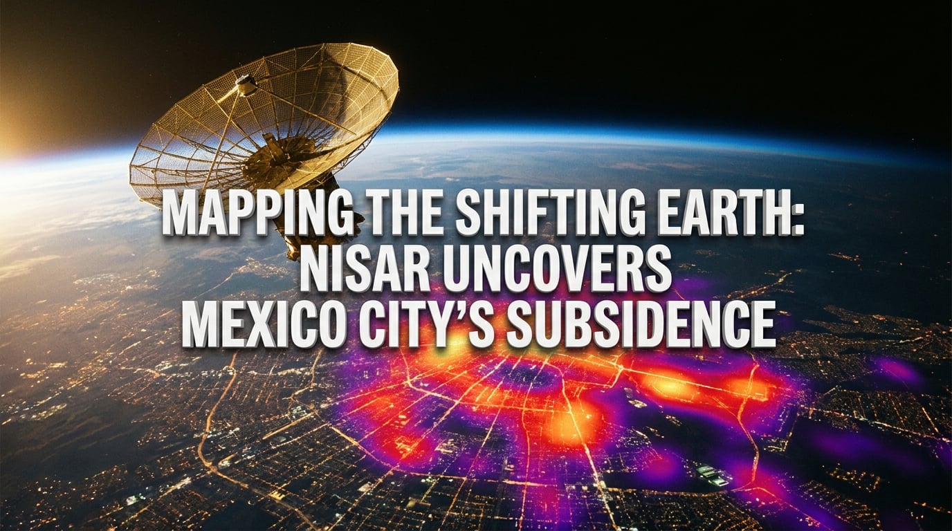
What if a metropolis of over 22 million people was slowly sinking into the earth, one half-inch at a time? This is the stark reality facing Mexico City,...
US-Indian NISAR Space Mission Maps Extreme Subsidence in Mexico City
What if a metropolis of over 22 million people was slowly sinking into the earth, one half-inch at a time? This is the stark reality facing Mexico City, where rapid geological shifting is threatening the structural integrity of one of the world's largest urban areas. But a revolutionary joint scientific effort—the US-Indian Space Mission Maps Extreme Subsidence in Mexico City—has now provided us with the most detailed look yet at this unfolding crisis.
Using NISAR (NASA-ISRO Synthetic Aperture Radar), one of the most powerful radar systems ever deployed in space, scientists have pinpointed regions of the capital sinking by more than half an inch per month. This extreme subsidence is largely driven by decades of aggressive groundwater extraction from the ancient clay lakebeds upon which the city was built. The physical toll is hard to ignore: historical landmarks are tilting, and foundational shifting is fracturing vital water pipes and transit lines across the valley.
This breakthrough matters right now because subsidence is no longer just a localized geological anomaly; it is a global urban crisis. From New York to New Delhi, major cities are sinking as aquifers dry up under the pressures of climate change and rapid urbanization. NISAR’s dual-frequency radar system offers an unprecedented template for tracking these minute surface changes in near-real-time. Managing such massive, globally distributed planetary data requires the same level of seamless collaboration we see in modern technology—much like how communication platforms like CallMissed allow global enterprises to orchestrate complex, multilingual operations across borders using advanced AI.
In this post, we will unpack how the NISAR satellite achieves this level of mapping precision, analyze the latest subsidence heat maps released by NASA and ISRO, and explore how this collaborative space mission is paving the way for smarter, data-driven urban planning in an era of climate uncertainty.
Introduction: Mapping Mexico City's Silent Crisis from Orbit
Imagine a metropolis of over 22 million people slowly, relentlessly sinking into the earth. This is the stark reality facing Mexico City, where rapid geological shifting is threatening the structural integrity of one of the world's largest urban areas. But a revolutionary joint scientific effort—the US-Indian Space Mission Maps Extreme Subsidence in Mexico City—has now provided us with the most detailed look yet at this unfolding crisis.
Using NISAR (NASA-ISRO Synthetic Aperture Radar), one of the most powerful radar systems ever deployed in space, scientists have pinpointed regions of the Mexican capital sinking by more than half an inch (1.3 centimeters) per month.
The Legacy of Lake Texcoco: Why the Capital is Sinking
To understand why Mexico City is sinking, one must look to its geological history. The modern metropolis is built on the ancient clay lakebeds of Lake Texcoco, which was systematically drained by Spanish colonizers centuries ago. Today, supplying water to the city's massive population requires pumping vast amounts of groundwater from aquifers deep beneath the surface.
As these underground aquifers are depleted, the overlying clay layers compact, causing the ground above to compress and collapse inward. The physical toll of this process is devastatingly apparent:
- Structural Damage: Historical landmarks, including the iconic Metropolitan Cathedral, are visibly tilting.
- Infrastructural Rupture: Shifting foundations regularly fracture vital water mains, worsening the city's existing clean water crisis.
- Transit Disruption: Subway tracks and highway overpasses are warping under the strain of uneven ground movement.
A Global Crisis Demands Planetary-Scale Data
This breakthrough matters right now because subsidence is no longer just a localized geological anomaly; it is a global urban crisis. From New York to New Delhi and Mumbai, major cities are sinking as aquifers dry up under the compounding pressures of climate change and rapid urbanization. NISAR’s dual-frequency radar system offers an unprecedented template for tracking these minute surface changes in near-real-time, giving urban planners the precise empirical data they need to mitigate disaster.
Managing such massive, globally distributed planetary data requires the same level of seamless collaboration we see in modern technology. Just as NASA and ISRO must orchestrate complex, multi-frequency radar signals across international agencies, modern enterprises must navigate highly complex, multi-lingual communication networks.
Platforms like CallMissed are solving this digital coordination challenge. By offering robust AI communication infrastructure, CallMissed enables organizations to deploy intelligent voice agents, handle speech-to-text natively in 22 regional Indian languages, and manage massive volumes of customer data with the same precision that space agencies use to map our shifting planet.
In this post, we will unpack how the NISAR satellite achieves this level of mapping precision, analyze the latest subsidence heat maps released by NASA and ISRO, and explore how this collaborative space mission is paving the way for smarter, data-driven urban planning in an era of climate uncertainty.
Background & Context: Why is Mexico City Sinking?
From Aztec Lake to Asphalt Jungle
The roots of Mexico City’s geological crisis lie deep in its pre-colonial past. Long before it became a bustling megacity of over 22 million people, the region was a vast, high-altitude basin dominated by five interconnected lakes, the largest of which was Lake Texcoco. When the Aztecs founded Tenochtitlan in 1325, they built a sophisticated system of dikes, causeways, and floating gardens (chinampas) to co-exist with the water.
However, following the Spanish conquest in 1521, colonizers chose a radically different approach: they aggressively drained the lakes to prevent seasonal flooding and make room for rapid urban expansion. This decision permanently altered the hydrology of the valley, replacing a dynamic aquatic ecosystem with a thick, saturated layer of highly compressible volcanic clay.
The Sponge Effect: Volcanic Clay and Compaction
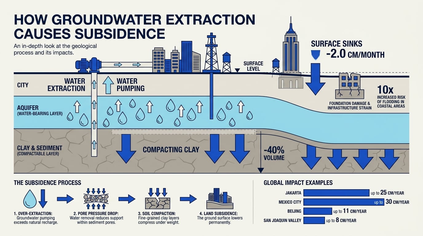
To understand why the ground is giving way, it helps to think of the underlying clay as a giant, water-soaked sponge. As long as the pores within the clay remain filled with water, the soil retains its volume and can support immense weight.
But Mexico City’s survival relies heavily on this very water. Today, approximately 70% of the capital’s drinking water is extracted from the underlying aquifer. As billions of gallons are pumped out annually to sustain the growing population:
- Pore water pressure drops: The structural support within the clay grains is lost.
- Soil compaction occurs: The clay particles collapse and pack tightly together under the sheer weight of the heavy urban infrastructure above.
- Irreversible sinking: Once these clay beds compact, they lose their elasticity. Even if the aquifers were completely refilled, the ground would never rise back to its original level.
A Vicious Cycle of Infrastructure Decay
This dramatic sinking creates a severe, self-reinforcing feedback loop. As the ground shifts unevenly—a phenomenon known as differential subsidence—it tears apart the city's underground utility networks. It is estimated that nearly 40% of Mexico City’s drinking water is lost to leaks caused by fractured pipes. To compensate for this massive loss, municipal authorities are forced to pump even more groundwater from the aquifer, which in turn accelerates the sinking.
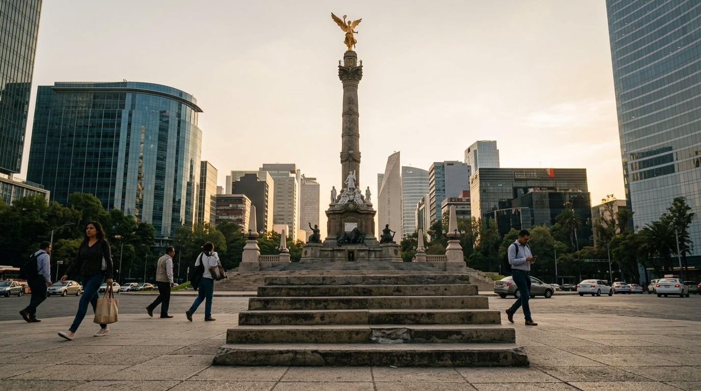
The physical manifestations of this crisis are striking. For example, at the base of the iconic Angel of Independence monument, engineers originally built nine steps leading up to the column. Because the surrounding ground has subsided so dramatically while the monument's deep-piled foundation remained anchored, city workers have had to add 14 additional steps over the decades to bridge the widening gap.
Managing a complex, multi-layered crisis of this scale requires rapid, precise coordination across hundreds of agencies. Just as modern global enterprises rely on robust communication infrastructure like CallMissed to seamlessly sync multi-layered operations and data flows in real-time, municipal engineers must now leverage next-generation spatial data to coordinate emergency infrastructure repairs and adapt to an ever-shifting landscape.
Key Developments: NISAR's Mission and Milestones
The realization of the NISAR (NASA-ISRO Synthetic Aperture Radar) mission represents an unprecedented milestone in international aerospace cooperation. Historically, tracking planetary-scale environmental changes with millimeter-level accuracy required aggregating disparate datasets from various space agencies—a process plagued by latency, data fragmentation, and formatting mismatches. By merging NASA's and ISRO's engineering capabilities into a singular, dual-frequency radar system, scientists can now monitor Earth’s dynamic crust with unparalleled consistency.
Just as platforms like CallMissed orchestrate high-bandwidth communication infrastructure across 300+ LLMs and 22 languages natively, the NISAR ground segment manages massive, multi-source telemetry feeds. This advanced data-orchestration pipeline ensures that complex radar signals collected in orbit are rapidly processed, translated, and disseminated to global researchers without friction.
The table below outlines the critical milestones, technical specifications, and collaborative operational frameworks that define the NISAR mission:
| Feature / Milestone | Agency Lead | Technical Specification | Strategic Scientific Impact |
|---|---|---|---|
| L-Band SAR Instrument | NASA / JPL | 24-centimeter wavelength; high-penetration radar | Penetrates dense vegetation and canopy cover to map underlying soil and ground shifts. |
| S-Band SAR Instrument | ISRO | 10-centimeter wavelength; high-sensitivity radar | Optimizes detection of near-surface features, crop patterns, and coastal ice dynamics. |
| Repeat Pass Frequency | Joint Operations | Systematic 12-day orbit cycle (ascending/descending) | Delivers a consistent time-series of surface deformation, critical for tracking active subsidence. |
| Spatial Resolution | Joint Operations | Down to 3–10 meters per pixel, depending on mode | Captures localized damage on specific streets, highways, and public transit corridors. |
| Open-Data Protocol | NASA & ISRO | Fully public, unrestricted global data distribution | Democratizes climate adaptation tools for vulnerable municipalities worldwide. |
Unpacking the Dual-Frequency Breakthrough
What makes NISAR a revolutionary tool for cities like Mexico City is its dual-frequency capabilities. Prior radar missions often struggled to map urban regions accurately because buildings, trees, and localized atmospheric interference distorted the signal. By combining L-band and S-band radar frequencies, NISAR can "see" through vegetation and track minute ground displacements—even those measuring less than a half-inch (1.3 centimeters) per month—regardless of weather conditions or canopy cover.
Moreover, the mission's strict 12-day orbital repeat cycle provides a continuous, high-definition timeline of how the Earth’s surface is moving. For urban planners, this means transitioning from retrospective damage assessments to proactive risk mitigation. Instead of waiting for a water main to burst or a historical monument to tilt past its structural threshold, municipal authorities can use NISAR's predictive heat maps to reinforce infrastructure before catastrophic failures occur. This level of continuous, global observation is setting a new benchmark for how we monitor and protect our rapidly urbanizing planet.
In-Depth Analysis: The Mechanics of Extreme Subsidence
To understand why Mexico City is sinking so rapidly, we must look beneath the pavement at a complex geotechnical struggle. The city's current crisis is a direct consequence of hydrogeology, soil mechanics, and aggressive urban development. When a massive metropolis is built on an unstable geological foundation, the physical consequences are both inevitable and catastrophic.
The Geotechnical Nightmare: Aquifers, Clay, and Consolidation
The primary driver of Mexico City’s dramatic descent is a geological process known as aquifer compaction or soil consolidation.
- The Saturated Sponge: The ancient clay of Lake Texcoco behaves much like a water-logged sponge. This clay is composed of highly porous, fine-grained volcanic ash and sediment that historically held massive volumes of water.
- The Pressure Drop: To supply water to over 22 million residents, the city heavily pumps groundwater from the aquifers beneath this clay layer. As water is drawn out, the pore-water pressure—the pressure of groundwater held within the soil's spaces—drastically decreases.
- Irreversible Compaction: Without the upward pressure of the water to support the weight of the city above, the clay particles collapse in on themselves. They pack tightly together, causing the ground to compress. Crucially, this compaction is irreversible; once the clay structure collapses, it can never expand back to its original state, even if the aquifers are refueled.
While the regional average sinking is stark, NISAR’s advanced radar mapping reveals that some localized sectors are dropping by more than half an inch (1.3 centimeters) every single month.
Differential Settlement: The True Destroyer of Infrastructure
The physical damage to Mexico City is not caused simply because the city is going down, but because it is going down unevenly. This phenomenon is called differential settlement.
The basin of Mexico City is a geological patchwork. Some districts, like the historical center, sit directly on top of the deep, highly compressible clay lakebeds. Other parts of the city, particularly in the south and west, are built on stable volcanic rock and ancient lava flows.
This stark contrast creates immense structural stress:
- Shearing Forces: As the clay-heavy zones sink rapidly while the rocky zones remain stationary, the ground literally tears itself apart.
- Fractured Pipelines: This shifting exerts massive shearing forces on underground infrastructure. Over 30% of Mexico City's potable water is lost to leaks, largely caused by water mains cracking under the strain of differential settlement.
- Tilting Landmarks: Heavy, historic stone structures tilt on their foundations, requiring expensive engineering interventions to prevent total collapse.
Translating Earth’s Micro-Movements into Actionable Data
Measuring these micro-movements across a sprawling metropolis requires incredible technical precision. The NISAR satellite achieves this by emitting radar signals that pierce through cloud cover and vegetation, measuring the distance to the ground down to the millimeter.
Processing this massive, continuous stream of spatial telemetry is an immense logistical challenge. Managing such complex, high-volume data pipelines mirrors the challenges faced in digital communication infrastructure. For example, platforms like CallMissed manage complex, multi-channel data streams—such as routing automated voice and chat across 22 regional Indian languages—ensuring that massive amounts of raw information are translated into clear, real-time actions. For urban planners, turning NISAR's raw radar telemetry into highly detailed subsidence heat maps is the first critical step toward saving a sinking city.
Impact & Implications: Infrastructure, Water Crisis, and Public Safety
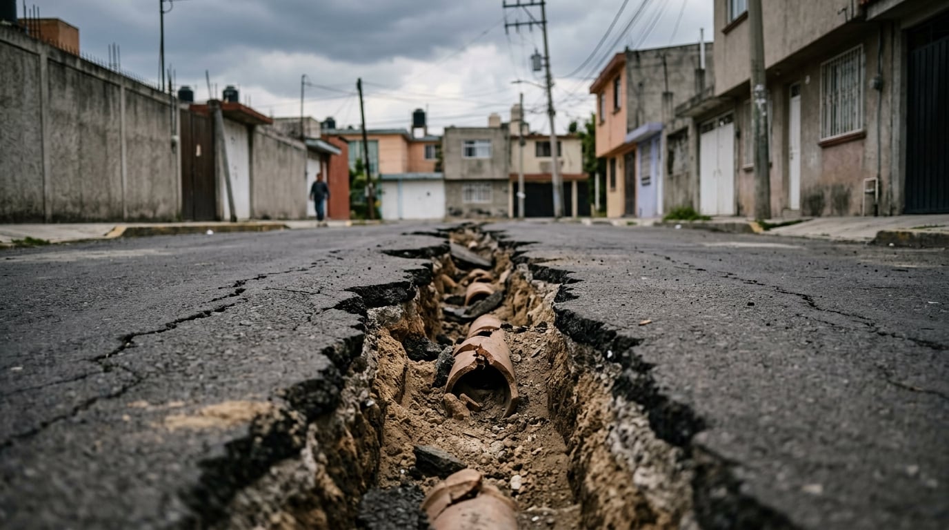
The extreme subsidence mapped by the NISAR satellite is not just a geological curiosity—it is a slow-motion disaster reshaping the daily lives of Mexico City’s 22 million residents. The impacts span across critical municipal infrastructure, a worsening water crisis, and immediate public safety hazards.
A Vicious Cycle: Water Scarcity and Fractured Pipes
At the heart of Mexico City's crisis lies a devastating irony. To supply water to its massive population, the city pumps vast quantities of groundwater from underground aquifers. As these aquifers are drained, the clay soil above them compresses, causing the ground to sink by more than half an inch (1.3 centimeters) per month in the hardest-hit areas.
This shifting earth shears, bends, and snaps underground water mains. It is estimated that nearly 40% of the city’s drinking water is lost to leaks caused by fractured pipes. This massive loss of treated water forces the municipality to pump even more groundwater to meet demand, which accelerates the compaction of the clay and drives the city further into the ground.
Compromised Infrastructure and Public Safety
The physical toll on the urban landscape is visible at every turn. Differential subsidence—where one part of a structure sinks faster than another—has led to tilted buildings, warped roadways, and fractured subway lines.
- Transportation Failures: Shifting tracks and cracked foundations frequently disrupt the Metro system, requiring costly, continuous maintenance to prevent catastrophic derailments.
- Sewage and Flooding: The city’s main drainage systems have lost their natural gravitational slope because different areas are sinking at uneven rates. During the heavy rainy season, this increases the risk of severe flooding and toxic wastewater backups.
- Historical Landmarks: The structural shifting is even consuming the city's history. For example, at the base of the iconic Angel of Independence, originally constructed in 1910, nine steps led to the monument. Because the surrounding ground has sunk so dramatically around its deep-piled foundation, fourteen additional steps have had to be constructed over the years to keep the base accessible.
Coordinating Crisis Response in Shifting Terrains
As geological shifts threaten public safety with sudden sinkholes or structural failures, the need for rapid, resilient municipal coordination becomes paramount. Managing these localized crises requires seamless, real-time flow of information between engineers, city officials, and affected communities.
Modern infrastructure depends on highly advanced technical solutions to bridge these gaps. For example, AI-driven communication platforms like CallMissed can assist municipal authorities in orchestrating rapid emergency responses. With capabilities like automated voice agents and multilingual support (including over 22 Indian languages for globally diverse cities), platforms like CallMissed allow local governments to deploy real-time alerts and handle thousands of citizen reports regarding pipe bursts or structural cracks simultaneously, ensuring public safety measures keep pace with a changing landscape.
Ultimately, the NISAR data serves as an urgent wake-up call. Without dramatic interventions in water management and urban engineering, Mexico City's infrastructure faces a compounding, costly battle against the very ground it stands on.
Expert Opinions: What Scientists and Urban Planners Are Saying
The publication of the latest NISAR data has sent waves through the international scientific and urban planning communities. For years, experts have warned of Mexico City’s impending water and structural crises, but the sheer precision of the joint NASA-ISRO radar imagery has transformed these warnings from generalized estimates into undeniable, hyper-localized facts.
The Geophysicist's View: The Power of Dual-Frequency Radar
Geophysicists specializing in geodesy—the science of measuring Earth’s shape and gravity field—are calling the NISAR dataset a watershed moment for environmental monitoring. Prior to this mission, tracking land subsidence at a city-wide scale required a patchwork of ground-based GPS stations and less frequent satellite passes, which often left critical blind spots.
According to remote sensing scientists, the key lies in NISAR's dual-frequency L-band and S-band Synthetic Aperture Radar. By utilizing these specific wavelengths, the satellite can penetrate vegetation and weather barriers to measure millimeter-scale changes in the Earth's crust every 12 days. Geophysicists point out that this frequent, high-resolution observation allows them to isolate natural tectonic movements from anthropogenic subsidence (sinking caused by human activity), giving them a clear, unvarnished look at how rapidly the clay beds of Lake Texcoco are compacting as water is extracted.
The Urban Planner's Dilemma: Mitigating "Differential" Subsidence
For Mexico City’s urban planners and structural engineers, the NISAR heatmaps are both a diagnostic tool and a dire warning. The primary concern is not just that the city is sinking, but that it is sinking unevenly—a phenomenon known as differential subsidence.
- Infrastructure Fractures: When one side of a neighborhood sinks faster than another, the resulting shear stress snaps underground water mains, cracks sewer lines, and deforms subway tracks.
- The Aquifer Catch-22: Because the city relies on groundwater for nearly 70% of its drinking water, pumping more water causes the clay to compress further, which in turn destroys the very infrastructure needed to distribute water.
- Sinking Heritage: Historical preservationists point out that iconic landmarks, such as the Metropolitan Cathedral, require constant, expensive engineering interventions just to keep them from tipping over as the ground beneath them deforms.
Urban planning experts argue that the only long-term solution is a radical overhaul of the city's water cycle, shifting away from aquifer exploitation toward aggressive rainwater harvesting and wastewater recycling.
The Communication Challenge: Turning Data into Action
A recurring theme among public policy experts is that high-fidelity satellite data is only useful if it can be translated into rapid local action. Managing the immense computational data generated by missions like NISAR and translating those findings into localized, multilingual public safety alerts is a massive logistical challenge.
In the digital era, overcoming these complex infrastructure hurdles requires sophisticated technology. Just as modern communication platforms like CallMissed enable global enterprises to orchestrate complex data pipelines and deploy multilingual AI voice agents to handle critical customer touchpoints seamlessly, municipal governments must build robust digital infrastructure to democratize space-based data. By integrating automated satellite alerts with localized communication systems, cities can warn residents, deploy repair crews to fractured pipelines, and coordinate emergency responses in real-time before structural failures occur.
What This Means For You: Local and Global Takeaways
The data captured by the NISAR mission does more than map Mexico City’s shifting topography; it provides a stark warning and a valuable blueprint for major metropolitan areas worldwide. While Mexico City represents an extreme case due to its unique clay-bed geology, land subsidence is a quiet crisis threatening coastal and inland cities globally. As groundwater resources deplete and urban populations swell, understanding these shifting baselines is critical for survival.
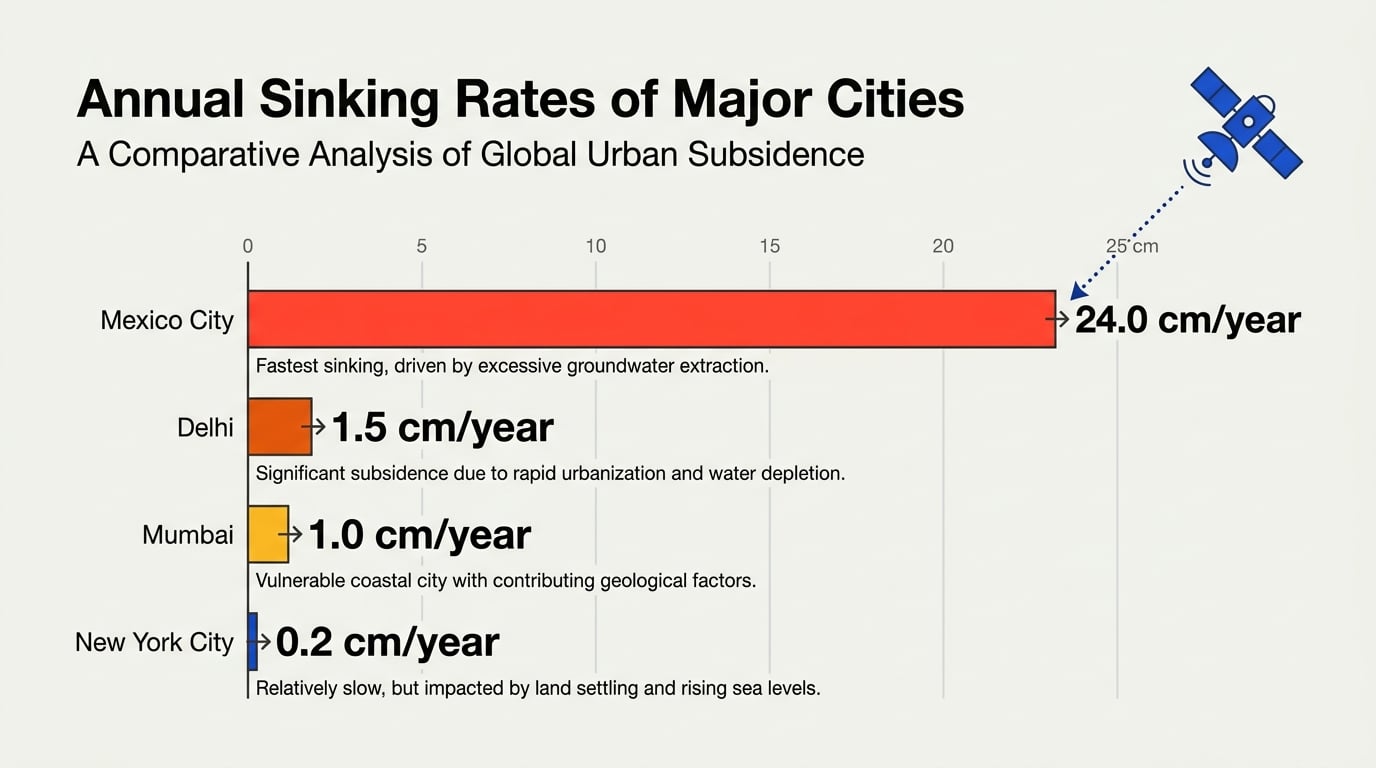
To put the scale of Mexico City’s crisis into perspective, the table below compares its subsidence metrics with other major global cities facing similar geological threats:
| City / Region | Sinking Rate (Approx.) | Primary Driver | Core Risk / Impact | Primary Monitoring Method |
|---|---|---|---|---|
| Mexico City, Mexico | >0.5 inches (1.3 cm) / month | Aquifer depletion & clay compaction | Ruptured water pipes, tilting landmarks | NISAR L-band & S-band radar |
| New Delhi, India | Up to 3.2 inches (8 cm) / year | Rapid groundwater extraction | Structural cracking in buildings | Satellite InSAR & ground sensors |
| Jakarta, Indonesia | Up to 10 inches (25 cm) / year | Excessive deep well pumping | Coastal inundation, seawater intrusion | GPS networks & radar altimetry |
| New York City, US | 0.04–0.08 inches (1–2 mm) / year | Massive building load & post-glacial shifting | Accelerated coastal flood risks | Sentinel-1 SAR mapping |
Local Impact: The Structural Toll on Urban Infrastructure
For residents of Mexico City, subsidence is not an abstract scientific concept; it is an expensive, daily reality. As the clay beds of ancient Lake Texcoco dry out and shrink, the ground settles unevenly. This differential sinking wreaks havoc on subterranean infrastructure, snapping sewer lines, fracturing clean water pipelines, and warping public transit tracks.
The visual evidence is striking. Consider the iconic Monument to Independence (El Ángel) in downtown Mexico City. When it was built in 1910, only nine steps led up to its base. Because the surrounding ground has sunk so dramatically while the monument's deep-set foundation piles have remained anchored, engineers have had to construct fourteen additional steps over the decades just to keep the base accessible from street level.
Global Impact: A Blueprint for Threatened Megacities
The collaborative efforts of NASA and ISRO show how space-based assets can transform local municipal planning. By using NISAR's dual-frequency radar, city planners around the world can transition from reactive damage control to proactive infrastructure reinforcement. Identifying exactly which city blocks are sinking allows authorities to target water-main reinforcements, restrict heavy vertical construction in vulnerable zones, and optimize aquifer recharge projects.
However, translating complex satellite telemetry into timely, actionable public safety measures requires seamless operational communication. During geological shifts or sudden water main failures, local governments must coordinate rapid emergency responses. Platforms like CallMissed enable cities and utilities to manage these crises efficiently, using multilingual AI voice agents and WhatsApp chatbots to instantly broadcast localized alerts and field resident reports in up to 22 regional languages. By combining space-age Earth observation with modern AI-driven communication infrastructure, global cities can build the resilience needed to survive a changing planet.
Frequently Asked Questions
How does the US-Indian Space Mission Maps Extreme Subsidence in Mexico City track land movement so accurately?
What is causing Mexico City to sink at such an extreme rate?
What are the key findings from the US-Indian Space Mission Maps Extreme Subsidence in Mexico City regarding sinking rates?
What is the NISAR satellite, and who is responsible for its development?
How does land subsidence in Mexico City impact daily infrastructure?
How can cities and researchers manage the massive volumes of spatial data generated by the NISAR mission?
Conclusion
The groundbreaking NISAR mission has illuminated a silent, global crisis unfolding right beneath our feet. As we look to the future, here are the key takeaways from this historic joint initiative:
- Severe Subsidence: Mexico City is sinking at an alarming rate of over half an inch per month, driven by aggressive groundwater extraction from ancient clay lakebeds.
- Unprecedented Precision: The dual-frequency radar of the NASA-ISRO satellite (NISAR) provides near-real-time, highly detailed mapping of minute surface displacements.
- A Global Warning: Urban subsidence is a planetary threat, with major metropolitan areas worldwide facing similar structural and environmental risks.
Moving forward, watch for how urban planners and environmental agencies globally integrate NISAR’s high-resolution datasets to reform groundwater policies and reinforce vulnerable infrastructure. Managing these immense, complex streams of global data requires the same level of seamless collaboration we see in modern technology. To explore how AI communication is evolving to help organizations orchestrate complex operations and exchange data in this fast-changing world, check out CallMissed—an AI infrastructure platform powering voice agents and multilingual chatbots for businesses. How will your organization leverage real-time data to navigate the challenges of tomorrow?
Discussion
Related Posts



Ready to automate customer conversations?
Launch AI voice agents and WhatsApp bots with CallMissed — one API, 22+ Indian languages.