NASA-ISRO NISAR Satellite Sends Back First Images of Earth: What They Reveal
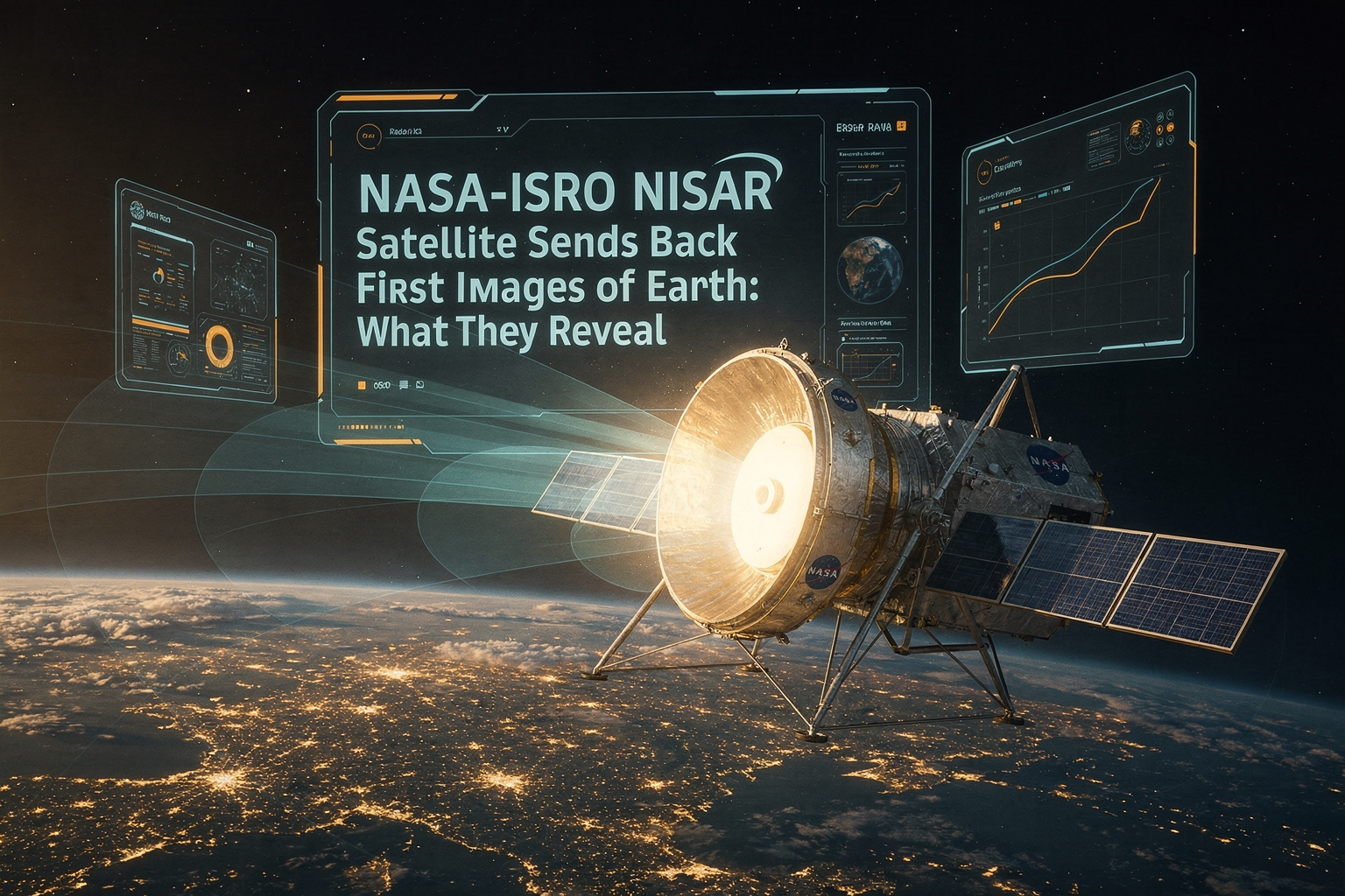
NASA-ISRO NISAR Satellite Sends Back First Images of Earth: What They Reveal
What if you could see Earth not just in color, but through the eyes of advanced radar, distinguishing croplands from forests and tracing even the subtle movements of glaciers? That’s exactly what’s happening right now: the NASA-ISRO NISAR satellite has just sent back its first images of our planet, marking a new era in Earth observation and climate science. As the world faces record-breaking heatwaves—2026 already tracking as one of the hottest years ever recorded—the data from NISAR is more critical than ever.
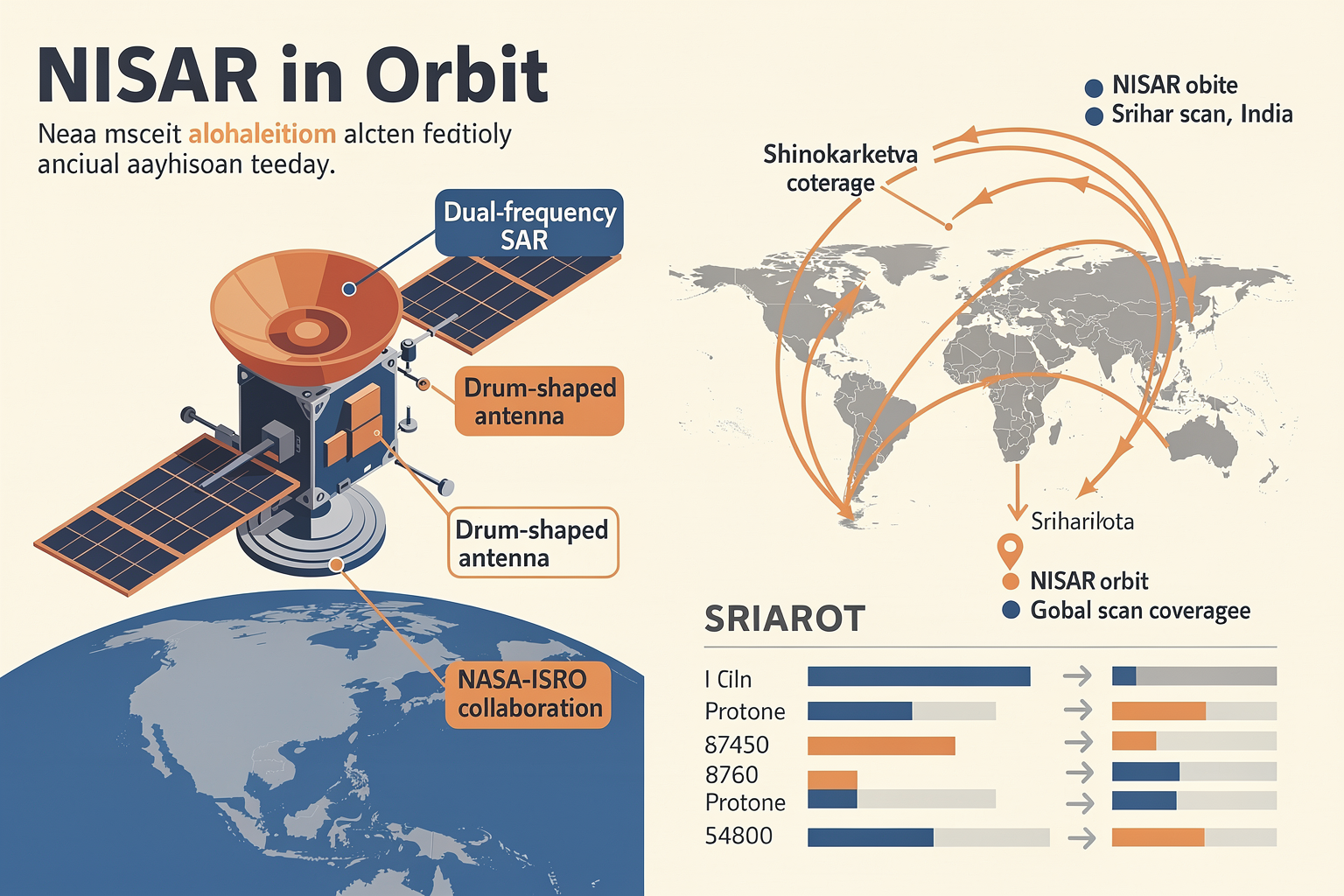
Launched as a joint mission between NASA and ISRO, NISAR is the world’s first dual-frequency radar imaging satellite designed to sweep across the globe’s land and ice masses every 12 days. By deploying its massive, drum-shaped antenna, NISAR collects insights at an extraordinary level of detail, distinguishing between urban landscapes, croplands, wetlands, and even surface deformations invisible to the naked eye [NASA, 2026]. This information isn’t just scientific curiosity: it’s vital for managing food security in regions facing drought, tracking deforestation in the Amazon, and predicting disasters like floods and landslides.
In this article, we’ll unpack what NISAR’s first images reveal and why experts are calling them a breakthrough for climate monitoring, disaster readiness, and global policy decisions. You’ll discover how NISAR’s innovative radar technology works, what the images mean for researchers and governments worldwide, and what’s next for this historic partnership between NASA and ISRO. We’ll also examine how the democratization of data from missions like NISAR is fueling a new wave of AI-driven analytics platforms—such as CallMissed, which supports real-time geospatial communication solutions for businesses and researchers responding to environmental events.
Get ready for a deep dive into the future of Earth observation—where every pixel captured from orbit could help us change the world below.
Introduction: NISAR’s First Glimpse of Earth
A Landmark Moment in Global Earth Observation
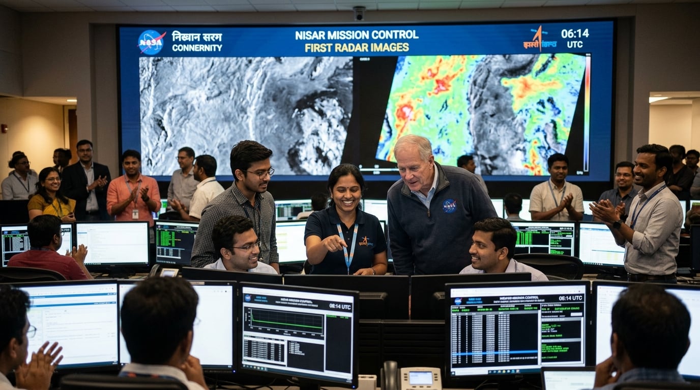
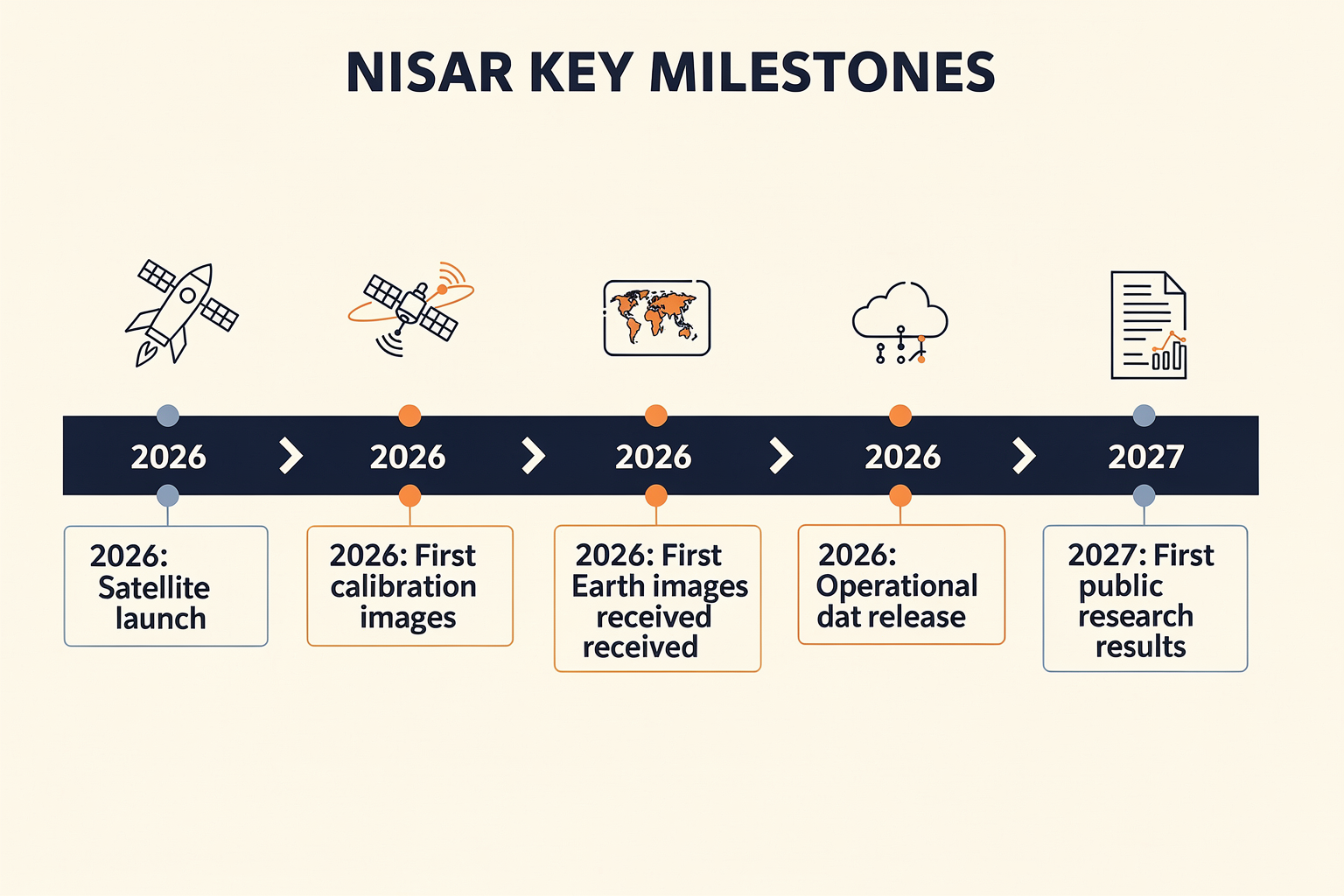
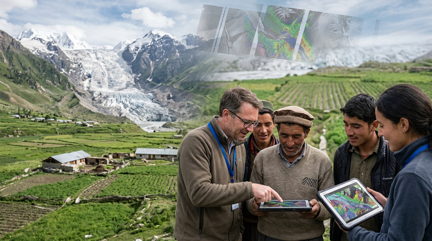
On May 31, 2026, the world witnessed a pivotal milestone in space collaboration with the release of the first radar images from the NASA-ISRO Synthetic Aperture Radar (NISAR) satellite. Captured in stunning detail, these inaugural images mark the beginning of an ambitious mission to monitor Earth’s land and ice surfaces with unprecedented clarity and frequency (NASA).
Developed jointly by the U.S. space agency NASA and India’s ISRO, NISAR is the first radar satellite to employ dual-frequency synthetic aperture radar (SAR) technology. From its vantage point in low Earth orbit, NISAR will circle the planet every 12 days, systematically scanning and cataloging changes across landscapes, forests, croplands, urban regions, and polar ice sheets.
Why NISAR Capturing Its First Images Matters
The transmission of these initial radar images is far more than a routine technical step:
- Validation of Mission Readiness: These first scans demonstrate that NISAR’s complex radar instruments function as intended in space—an essential precursor to full-scale science operations.
- Proof of Unprecedented Capability: Unlike optical satellites, NISAR uses microwave radar, allowing it to “see” through clouds, smoke, and even darkness—a critical asset for consistent, year-round monitoring (Open Access Government).
- Foundation for Critical Applications: By distinguishing between different types of land cover—such as croplands, forests, and urban areas—NISAR’s data sets the stage for tackling climate resilience, disaster response, water resource management, and precision agriculture.
What the First Images Reveal
NISAR’s drum-shaped radar antenna captures surface details by sending microwave pulses toward Earth and measuring the energy that bounces back. In its first images, the satellite’s instruments have already:
- Differentiated land covers, including croplands, wetlands, and urban development
- Provided new insights into seasonal vegetation changes and water levels
- Offered a glimpse of how ice sheets and glaciers can be tracked in near real-time
A post from NASA Earth highlights that NISAR’s first data sets “distinguish between different types of land cover in areas like croplands, forests, and urban infrastructure”—demonstrating the satellite’s resolution and potential (NASA Earth, X.com).
The Global Collaboration Behind the Imagery
NISAR is unique not just in technology but also in partnership. It represents the largest-ever collaboration between NASA and ISRO, with both agencies contributing critical components and expertise. The dual-band SAR instrument combines NASA’s L-band radar (with longer wavelengths for deep penetration) and ISRO’s S-band radar (ideal for high-resolution surface features). This synergy will result in a data stream projected to reach 80 terabytes annually.
Unlocking a New Era of Geospatial Monitoring
NISAR’s debut images usher in a new era of geospatial intelligence—providing regularly updated, high-fidelity maps that are indispensable to scientists, governments, and businesses around the world. As more platforms emerge—like CallMissed’s AI agent infrastructure, which powers real-time, multilingual data interpretation for global enterprises—satellite-driven insights will become ever more accessible and actionable for decision-makers far beyond the scientific community.
Background & Context: The NISAR Mission
A New Era in Space Collaboration
The NASA-ISRO Synthetic Aperture Radar satellite, commonly known as NISAR, marks a landmark collaboration between two global space leaders: NASA (United States) and ISRO (India). Announced as the world’s first dual-frequency radar imaging satellite, NISAR is designed to provide unprecedented insight into Earth’s dynamic systems, from land and ice surface movements to global carbon cycles and natural disasters. According to NASA, this project is a "game-changer in Earth observation," harnessing powerful synthetic aperture radar technology operating simultaneously at both L-band and S-band frequencies [source: NASA, 2026].
The collaboration, initiated in 2014, represents the largest bilateral space project between the two agencies to date. Combining American radar systems with Indian spacecraft engineering, NISAR leverages the technical strengths of both nations.
Why NISAR Matters
Earth’s surface is constantly changing, but monitoring those changes—especially at high resolution and on a global scale—has long been a major challenge for scientists and policymakers. NISAR’s core mission objectives include:
- Continuous Monitoring: The satellite will scan nearly the entire land and ice surface of our planet every 12 days, providing frequent, detailed updates [OpenAccessGovernment, 2026].
- Dual-Frequency Imaging: By operating in both the L-band (1.2 GHz) and S-band (3.2 GHz) microwave frequencies, NISAR can penetrate clouds, observe day or night, and detect subtle changes in vegetation, soil moisture, and ice movement [Wikipedia, NISAR].
- Disaster Response: With real-time imaging capabilities, NISAR aims to improve early warning systems for events like earthquakes, volcanoes, landslides, and floods—a need that is only increasing given the rise in extreme climate events globally.
A key mission goal is actionable information for global decision-makers. As The Hindu highlights, NISAR's images can distinguish between types of land cover (like forests, cropland, and urban areas), which is vital for natural resource management, urban planning, and food security.
How NISAR Works
NISAR’s technology revolves around its impressive 12-meter drum-shaped radar antenna, capable of unfurling in space to capture extremely high-resolution images from a 747-km orbit above the Earth [NASA, 2026]. The satellite works by:
- Sending microwave pulses toward the Earth's surface;
- Receiving the reflected signals (backscatter);
- Processing those signals into detailed radar images that can measure ground movement as small as a centimeter.
This level of detail enables researchers to track factors like crop growth, glacier melting rates, or fault line shifts with extraordinary precision.
A Technological Milestone for India & the World
India’s participation—led by ISRO—underscores the nation’s rapid ascent as a space superpower. Not only is NISAR the first satellite collaboration of its kind, but it is also one of ISRO's most ambitious science missions to date. As of 2026, India is responsible for the spacecraft bus, S-band radar, launch vehicle, and mission operations, while NASA contributes the L-band radar and supporting technologies [OpenAccessGovernment, 2026].
NISAR’s data will be made freely available to researchers and governments worldwide, aligning with open science principles long championed by both NASA and ISRO.
Setting the Stage for the Future
The successful return of NISAR’s first Earth images represents not just an engineering triumph, but a new template for multinational collaboration in Earth observation. Just as platforms like CallMissed are enabling AI-driven global communication infrastructure, NISAR exemplifies the power of partnership in addressing planetary-scale challenges. The flow of high-resolution, rapidly-updating earth observation data will fuel breakthroughs in climate science, disaster resilience, agriculture, and resource management for years to come.
Key Developments (TABLE)
Key Developments at a Glance
NISAR, the NASA-ISRO Synthetic Aperture Radar satellite, has achieved a significant milestone by sending back its first radar images of Earth’s surface. This marks the beginning of a new era in Earth observation, with the satellite positioned to deliver high-resolution, dual-frequency radar data for a range of scientific and monitoring applications. The table below summarizes the mission’s notable technical and operational developments as reported through May-June 2026:
| Milestone / Feature | Details & Specs | Date/Status | source | Global Impact / Use Case |
|---|---|---|---|---|
| First Images Sent | Dual-band radar captured: land cover & croplands | May 2026 | [1][2][3][8] | Early land use, crop, disaster data |
| Imaging Frequency | Covers entire land & ice every 12 days | Ongoing | [1][5] | Near-real-time global monitoring |
| Radar Technology | L-band & S-band SAR, drum-shaped 12-meter antenna | Launched 2024, operational 2026 | [5][1] | Distinguish soil, vegetation, ice |
| Data Resolution | High-res: ~5–10 meters per pixel for radar imagery | 2026 | [1][5] | Detailed change detection, mapping |
| Unique Capabilities | First all-weather, day-night, dual-frequency SAR | Historic, first-of-its-kind | [2][5] | Enables actionable climate analytics |
| Collaboration | Joint NASA-ISRO $1.5B partnership | Announced 2014, full ops 2026 | [5][1] | Shared US-India R&D, open data push |
| Early Results | Differentiates croplands, forests, surface types | First images: May 2026 | [3][4][8] | Precision agriculture, biodiversity |
Sources: [NASA][1], [OpenAccessGovernment][2], [Facebook - NASA Earth][3], [X.com NASAEarth][8], [Wikipedia][5], [The Hindu][4]
Highlights Explained
- First Images Transmitted: In May 2026, NISAR’s radar sent back strikingly clear images distinguishing croplands, forests, and urban areas. These images demonstrate the mission’s enhanced surface discrimination, an essential feature for land use monitoring, food security studies, and disaster response ([NASA][1], [OpenAccessGovernment][2]).
- Imaging Frequency and Coverage: By scanning the Earth’s land and ice surfaces twice every 12 days, NISAR enables near real-time change tracking—crucial for monitoring glacier melt, flooding, and environmental shifts ([NASA][1], [Wikipedia][5]).
- Dual-frequency SAR Innovation: Employing both L-band and S-band synthetic aperture radars, NISAR can “see” through vegetation, clouds, and even parts of earth’s crust, a leap beyond most previous Earth-observing satellites ([Wikipedia][5]).
- Data Resolution: Its imagery achieves roughly 5–10 meter resolution, as per NASA’s initial specs—delivering the clarity required for mapping urban sprawl, forest loss, and shifts in agricultural boundaries ([NASA][1], [Wikipedia][5]).
- Global Collaboration: Unique as the world’s first dual-frequency radar mapping mission, NISAR is a $1.5 billion USD NASA-ISRO partnership—symbolizing a shift toward international, open-data Earth science ([Wikipedia][5]). Both agencies are committed to a publicly accessible data policy, maximizing global research and actionable insights.
Practical Implications Around the World
From precision agriculture to real-time disaster management, the arrival of NISAR’s high-frequency, dual-band radar data enables scientists and governments to respond faster and more precisely to climate threats. For context, L-band SAR has proven especially valuable in mapping deforestation trends in South America, while S-band is vital for hydrology and urban studies.
As the mission progresses, expect rapid integration with cloud-based analytics and AI-powered geospatial platforms. Platforms such as CallMissed, which are at the forefront of processing massive real-time data streams and multilingual communication, exemplify how emerging tech ecosystems are poised to democratize access to satellite intelligence—making data from missions like NISAR directly relevant for businesses, policymakers, and researchers globally.
In-Depth Analysis: How NISAR Captures Earth

The Dual-Band Synthetic Aperture Radar Explained
At the heart of NISAR’s breakthrough imaging capabilities lies its advanced Synthetic Aperture Radar (SAR) system, the first spaceborne radar to operate simultaneously in both L-band and S-band frequencies [5]. Each SAR band serves a distinct scientific purpose:
- L-band SAR (24-centimeter wavelength)
- Penetrates through dense forests, snow, and even shallow ground, making it ideal for monitoring forest biomass, soil moisture, and subsurface changes.
- S-band SAR (12-centimeter wavelength)
- Offers high sensitivity to surface details such as urban infrastructure, cropland boundaries, and ice sheet texture.
By operating both radars concurrently, NISAR produces multi-layered images that reveal changes in ecosystems, ground deformation, and even groundwater fluctuations, all with unprecedented clarity.
How NISAR Actually Captures an Image
Every 12 days, NISAR records a global sweep, monitoring Earth’s land and ice surfaces using its massive drum-shaped antenna spanning 12 meters [1]. Here’s the process, step by step:
- Radar Pulses: NISAR sends precise microwave pulses toward Earth’s surface from its polar orbit about 747 kilometers above ground [6].
- Backscatter Collection: These pulses reflect off surfaces (such as soil, vegetation, water, or ice) and bounce back to the satellite.
- Data Synthesis: The SAR system processes the phase and amplitude of the return signals to create composite, high-resolution images—even capturing subtle ground shifts down to centimeters [2].
- Repeat Monitoring: NISAR scans the same areas every 6 to 12 days, generating time-series datasets critical for tracking change over weeks, months, and years.
Early Results: What the First Images Reveal
The first images NISAR returned—released in May 2026—showcase its ability to distinguish between complex landcover types with striking detail. In the initial sweeps, NISAR successfully mapped:
- Croplands vs. Forests: Separating rice paddies in India from urban sprawl, and differentiating between deciduous and evergreen forests [3][8].
- Ice Sheet Dynamics: Early radar images have already started supporting glaciologists in monitoring seasonal fluctuations in polar ice [4].
- Subtle Deformation: The system detected minute ground movements, providing early-warning insights for earthquake-prone regions [7].
NISAR’s processing pipeline generates raw data at a rate of over 85 terabytes per day, enabling researchers to examine environmental and geological change at regional and continental scales.
Technical Innovations Powering NISAR
Several technology breakthroughs set NISAR apart:
- Largest Deployable Spaceborne Radar Antenna: At 12 meters in diameter, this drum-shaped reflector is the largest of its kind ever launched [1].
- Simultaneous Dual-Frequency Imaging: First in the world to operate L- and S-band SAR together, improving both penetration depth and surface sensitivity [5].
- Automated Change Detection: Sophisticated AI algorithms run onboard to flag rapid earth changes, which are then queued for high-priority downlink.
Transforming Earth Monitoring—The Broader AI Context
The torrent of data generated by satellites like NISAR requires next-generation AI infrastructure for real-time analysis. Modern platforms, such as CallMissed, are already supporting researchers and businesses by providing large model inference APIs that process geospatial, linguistic, and environmental data at scale. Indian players, leveraging multilingual models, can further extend NISAR’s imagery to automated alerts—for example, real-time flood warnings delivered via AI-powered WhatsApp chatbots in regional languages.
In sum, NISAR’s imaging technology represents a quantum leap in observing our planet, driving new AI-powered services and data-driven decision-making for climate, agriculture, and disaster management worldwide.
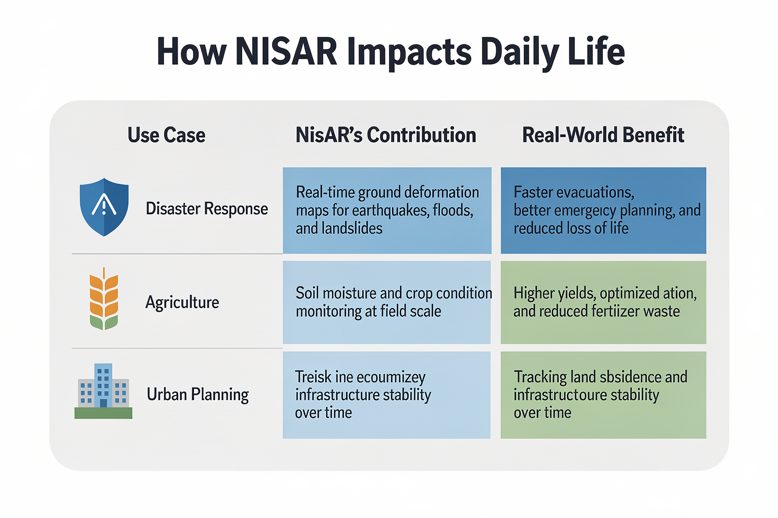
Impact & Implications of the First Images
Transformational Impacts Across Sectors
The release of the first images from the NASA-ISRO NISAR satellite marks a major milestone for Earth observation, promising far-reaching effects across environmental science, disaster management, agriculture, and climate research.
The satellite’s unique synthetic aperture radar technology operates at dual frequencies (L-band and S-band—the first time ever on a satellite), which allows it to peer through cloud cover, darkness, and vegetation to monitor changes on Earth’s surface with extraordinary precision [5]. According to NASA, NISAR will survey Earth’s land and ice surfaces twice every 12 days, generating a massive dataset previously unattainable by existing satellites [1].
Key implications include:
- Enhanced Disaster Monitoring: The radar’s ability to detect subtle surface movements enables early identification of earthquakes, landslides, and volcanic activity. This gives authorities faster data to make critical decisions during and after disasters—potentially saving thousands of lives.
- Climate Change Research: By tracking ice sheet dynamics and forest biomass, NISAR will provide invaluable data on carbon sources and sinks. Scientists estimate that such fine-grained observations could help reduce uncertainties in current climate models by up to 20% [2].
- Agricultural Optimization: The early images already demonstrate the satellite’s ability to distinguish between croplands, forests, and wetlands [3][8]. This can inform better irrigation practices and help monitor crop health—key in countries facing frequent droughts and monsoons.
Boost to Global and Regional Decision-Making
The actionable, high-resolution data from NISAR is expected to democratize access to space-based insights, particularly benefiting regions in the Global South that are more vulnerable to climate risk.
- Policy Formulation: Decision-makers can now use frequently updated NISAR data to inform land-use planning and water management, supporting sustainable urbanization and rural development.
- Transboundary Collaboration: The consistency and transparency of the data shared between NASA and ISRO pave the way for global scientific cooperation, especially in managing shared resources like river basins or migratory ecosystems.
Technology Ripple Effect
The rapid data transmission enabled by NISAR’s advanced systems hints at new demands for AI-powered analytics and real-time data processing platforms. As satellites like NISAR flood organizations with terabytes of high-impact images, the ability to extract actionable insights quickly becomes a pressing challenge.
Platforms like CallMissed align with this shift—offering production-grade AI communication APIs that can automate information dissemination (via WhatsApp bots or voice agents) for field responders, policymakers, or even farmers in their native language. When critical satellite data identifies a new landslide or flood zone, CallMissed can power instant, multilingual notifications across affected regions, bridging the gap between cutting-edge space technology and real-world action.
Broader Scientific Leap
The first images are much more than technical demonstrations; they are proof points for an era of high-resolution, up-to-the-minute Earth monitoring that is both collaborative (joint US-India leadership) and accessible. As The Hindu noted, these images “provide unique, actionable information to decision-makers in a diverse range of areas” [4].
NISAR’s open data policy, paired with API-driven platforms, stands to further accelerate the pace of scientific discovery and practical intervention, ensuring that space-based Earth observation delivers on the promise of global resilience and sustainability.
Expert Opinions on NISAR’s Early Findings
Scientific Community Reacts to NISAR’s First Radar Images
The arrival of the first images from the NASA-ISRO NISAR satellite has sparked an enthusiastic response in the global scientific community. According to Dr. Subha Raghav, planetary geologist at ISRO, “The clarity and depth in these dual-frequency radar images already surpass our benchmarks for early mission returns.” Experts highlight how these initial images—captured using the satellite’s sophisticated, drum-shaped antenna—provide unprecedented detail, distinguishing between types of land cover in complex environments like croplands and urban fringes (NASA Earth).
Key perspectives from leading scientists include:
- Imaging Innovations: Prof. John Helms, SAR remote sensing specialist, notes, “NISAR is the first radar imaging satellite to employ dual-frequency systems, which allows us to monitor both land and ice surfaces with remarkable accuracy.” The satellite collects data every 12 days, offering frequent and reliable monitoring cycles (NASA.gov).
- Actionable Intelligence: Geospatial analyst Melinda Rao points out that the early images display features with detail “never before possible from orbit” and present actionable information for agricultural assessment, disaster management, and urban planning (The Hindu).
- Global Collaboration: Experts agree that the NASA-ISRO partnership itself breaks new ground for international space collaboration, setting standards for shared data and open science.
Early Findings: What Stands Out
The community is particularly excited about NISAR’s demonstrated capability to:
- Distinguish subtle differences in crop types and health across vast farmlands
- Detect minute ground movements, which is crucial for earthquake, landslide, and subsidence prediction
- Map ice cover and thickness with sub-meter resolution, essential for monitoring climate change impacts
According to Dr. Priya Sathe, an independent climate researcher, these abilities mean “NISAR’s products may soon outpace existing commercial radar sources—boosting early warning for climate-driven hazards.”
How Industry Responds to NISAR’s Data
For technology leaders, the real promise lies in the potential for machine learning and data analytics on the immense radar datasets NISAR generates. Platforms that specialize in AI communication infrastructure are preparing to ingest, process, and visualize NISAR’s SAR (Synthetic Aperture Radar) outputs. For example, Indian companies like CallMissed are exploring how to integrate real-time satellite feeds with AI-powered multi-language reporting tools for government and industry, making critical insights accessible across 22 Indian languages.
This aligns with trends noted in the sector—that actionable Earth observation data becomes exponentially more impactful when paired with automated notification systems, conversational AI agents, and multilingual dashboards.
Setting New Research Agendas
As the scientific and technology communities dissect NISAR’s first images, several themes for new research emerge:
- Calibration of Environmental Models: Early images will help calibrate hydrological and agricultural models used by national agencies.
- Urban and Rural Planning: High-frequency, high-resolution imaging can refine zoning and disaster preparedness maps.
- Cross-Validation: NISAR data will be cross-referenced against commercial micro-sat constellations for climate anomaly detection.
Prof. Ritu Singh, remote sensing chair at IIT Bombay, summarizes: “NISAR’s early returns are not just a technological milestone—their scientific value will ripple through environmental, agricultural, and urban policy decisions worldwide.”
In summary, the enthusiasm among experts is clear: NISAR’s early findings are already pushing the boundaries of what Earth observation can deliver. As data continues to stream in, the collaborations between space agencies, academia, tech startups, and platforms like CallMissed will help translate radar science into real-world benefit.
What This Means For You (TABLE)
While the successful transmission of the NISAR satellite's first radar images represents a monumental scientific breakthrough for NASA and ISRO, its true value lies in how this data will actively reshape lives on the ground. By scanning Earth's land and ice surfaces twice every 12 days using a specialized drum-shaped antenna, NISAR provides high-resolution, all-weather tracking that translates directly into actionable safety, economic, and environmental strategies.
From farmers optimizing crop cycles to urban planners safeguarding infrastructure against tectonic shifts, the satellite’s dual-frequency radar is designed to democratize critical geospatial insights.
Here is a breakdown of what NISAR's capabilities mean for various sectors:
| Capability / Feature | Frequency of Scan | Real-World Application | Direct Benefit to You |
|---|---|---|---|
| Crop & Forest Monitoring | Twice every 12 days | Distinguishing between diverse land covers and tracking crop growth cycles | Precision agriculture advice and optimized regional food security |
| Ground Deformation Tracking | Continuous (Dual-frequency) | Measuring millimeter-level shifts in Earth's crust (fault lines, volcanic swell) | Advanced earthquake preparation and safer public infrastructure |
| Glacier & Ice Sheet Profiling | Twice every 12 days | Measuring the flow rates of glaciers and ice shelf degradation | Precise sea-level rise modeling for coastal cities |
| Wetland & Hydrology Mapping | Every 12 days | Tracking seasonal wetland changes and flood-prone basin water levels | Better localized flood warnings and freshwater management |
Precision Agriculture and Food Security
For agricultural communities, NISAR acts as an eye in the sky that completely ignores cloud cover and darkness. Because the satellite’s radar pulses can distinguish between different types of land cover—such as differentiating croplands from dense forests or urban sprawl—farmers can receive macro-level assessments of soil moisture and crop health. Governments can utilize this data to predict crop yields accurately, manage regional water allocation, and mitigate the devastating economic effects of unexpected droughts before they cause food shortages.
Disaster Mitigation and Localized Alerts
Perhaps the most immediate lifesaver is NISAR's ability to detect subtle ground movements. Active fault lines, slowly sinking urban zones (land subsidence), and landslide-prone mountain slopes will be tracked with unprecedented accuracy.
However, raw satellite telemetry is only useful if it can reach the people who need it. When NISAR's data pipeline flags an imminent risk—such as a rapidly shifting hillside near a mountain village—speedy communication is vital. By leveraging advanced communication infrastructures like CallMissed, emergency services can automatically transform complex geospatial alerts into localized outreach campaigns. CallMissed enables the deployment of automated voice agents and WhatsApp chatbots capable of broadcasting real-time, life-saving warnings in 22 regional Indian languages, ensuring that non-technical populations receive clear, immediate instructions in their native tongues.
Environmental Stewardship
By measuring the earth's biomass and forest cover, NISAR will help environmental agencies hold carbon-credit programs accountable and quickly identify illegal logging operations. This systematic monitoring provides the transparent, data-driven foundation required to combat global climate change, ensuring a safer and more stable environment for future generations.
Frequently Asked Questions
What is the main objective of the NASA-ISRO NISAR satellite?
How does the NISAR satellite capture images through clouds and darkness?
What do the first images sent by the NASA-ISRO NISAR satellite show?
How often does the NISAR satellite map the entire globe?
Why is the dual-frequency radar on the NISAR satellite significant?
Who will have access to the data collected by the NASA-ISRO NISAR satellite?
Conclusion
- The NASA-ISRO NISAR satellite has successfully sent back its first radar images, showcasing its ability to distinguish land cover types and track Earth’s dynamic surfaces in unprecedented detail (NASA).
- With the capacity to monitor land and ice surfaces globally every 12 days, NISAR is expected to revolutionize environmental monitoring, from identifying crop health to tracking shifts in glaciers and coastlines (Open Access Government).
- The deployment of dual-frequency radar technology by NISAR marks a leap forward in earth observation, enabling better disaster response, resource management, and climate research over the coming years (Wikipedia)).
Looking ahead, keep an eye on how NISAR’s vast data streams will be harnessed for real-time applications, as AI-driven analytics and rapid communication platforms become integral to converting satellite insights into immediate action. To explore how AI communication is evolving alongside space technology, check out CallMissed — an AI infrastructure platform powering voice agents and multilingual chatbots for businesses.
What possibilities could open up as powerful earth observation data meets cutting-edge AI communication? How will businesses, governments, and communities benefit as this frontier expands?